Several major Colorado Springs roads mistakenly labelled as closed on Google Maps Monday

Several major Colorado Springs roads mistakenly labelled as closed on Google Maps Monday

  • 18.03.2025 03:49
  • gazette.com
  • Keywords: Road Closure, Google Maps, Waze

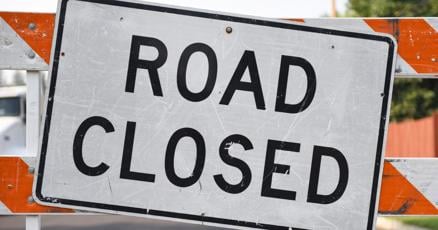
Several Colorado Springs roads were incorrectly marked as closed on Google Maps and Waze, including Nevada Avenue and Constitution Avenue. Despite being open, these closures remain listed with end dates in late March and early April. Apple Maps did not show the errors, while the city is investigating the issue.

Alphabet ServicesAAPLsentiment_satisfied

Estimated market influence

Google

Negativesentiment_dissatisfied
Analyst rating: N/A

Google Maps mistakenly labeled several roads as closed in Colorado Springs, potentially causing confusion for drivers. The company's failure to respond to the issue may lead to public frustration and loss of trust.

Waze

Negativesentiment_dissatisfied
Analyst rating: N/A

Waze also incorrectly marked road closures, similar to Google Maps, affecting drivers in Colorado Springs. No response from Waze was noted.

Apple

Apple

Positivesentiment_satisfied
Analyst rating: Buy

Apple Maps accurately displayed road conditions, avoiding confusion for users. This reflects positively on Apple's mapping services reliability.

Context

Analysis and Summary: Business Insights and Market Implications

Key Facts and Data Points:

  • Incorrect Road Closures: Several major Colorado Springs roads were mistakenly labeled as closed on Google Maps and Waze, including:

    • Nevada Avenue (5-mile segment)
    • Constitution Avenue (10-mile segment)
    • Cascade Avenue
    • Brookside Street
    • West Fillmore Road
    • Austin Bluffs Parkway
    • Wahsatch Avenue
  • Timeframe: Closures were reported around 2 p.m. on Monday and had end dates in late March and early April.

  • Current Status: As of publishing, roads remain labeled as closed despite being open.

  • Competitor Behavior: Apple Maps did not show the erroneous closures, maintaining accurate road information.

Market Trends and Business Impact:

  • Mapping Service Accuracy: The incident highlights potential flaws in Google Maps and Waze's data processing, particularly regarding real-time construction or maintenance updates.
  • User Trust: Misleading closure information could damage user trust, leading to reputational risk for the affected platforms.
  • Competitive Dynamics: Apple Maps' accuracy may position it as a more reliable alternative, potentially attracting users concerned with real-time data integrity.

Strategic Considerations:

  • Communication Strategy: Google's lack of response to media inquiries raises questions about its crisis management and transparency practices.
  • Data Reliability: The incident underscores the importance of robust data verification processes for mapping services to maintain user confidence.

Long-Term Effects and Regulatory Implications:

  • Potential Market Shifts: If users lose trust in Google Maps and Waze, competitors like Apple Maps could gain market share.
  • Regulatory Scrutiny: While not explicitly mentioned, such incidents may prompt regulators to examine data accuracy standards for digital mapping services.

Conclusion:

The erroneous road closures in Colorado Springs reveal critical vulnerabilities in real-time mapping platforms. Businesses relying on these tools for traffic management, tourism, and emergency response face risks due to potential inaccuracies. Moving forward, companies like Google and Waze must prioritize data verification and improve communication with users and stakeholders to mitigate reputational and operational risks.